Subject: Caribbean, Florida
Period: 1750 (circa)
Publication: Atlas Geographicus
Color: Hand Color
Size:
14.2 x 13.6 inches
36.1 x 34.5 cm
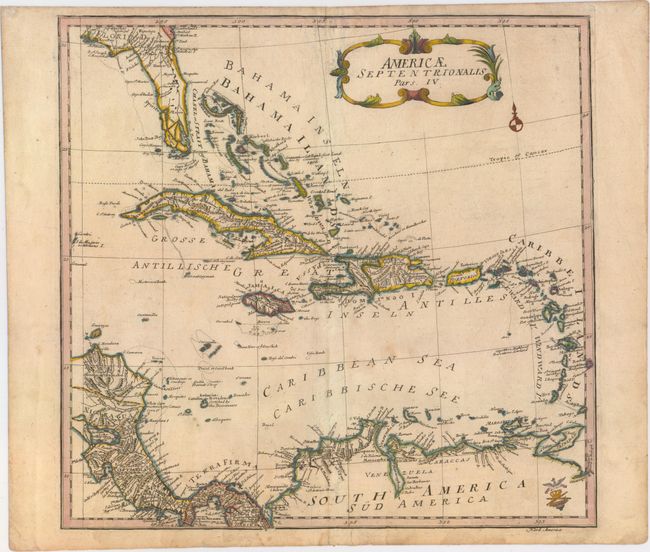
This scarce German map of the Caribbean and Central America is part of a four-sheet map of North America. Each sheet stands alone with a decorative cartouche and full borders. The map is nicely detailed with place names in both German and English and shows many of the smaller islands, shoals and reefs. The map extends north to Cumberland Island, Georgia and west to Pensacola, Florida. Florida is quite narrow with southern Florida depicted as a series of large islands. A number of rivers and small lakes fill the peninsula. In contrast, there is little inland detail in South America, where Lake Maracaibo is given an elongated, narrow shape. The map is adorned with a decorative title cartouche, small compass rose, and Euler's engraved "cum privilegio" stamp at bottom right.
References: Sellers & Van Ee #86.
Condition: B+
Watermarked paper with light soiling and a few minor creases.