Catalog Archive
Auction 151, Lot 363

"Carte Generale des Iles Antilles et du Golfe du Mexique Dressee d'Apres les Travaux Anglais et Espagnols", Robiquet, Aime

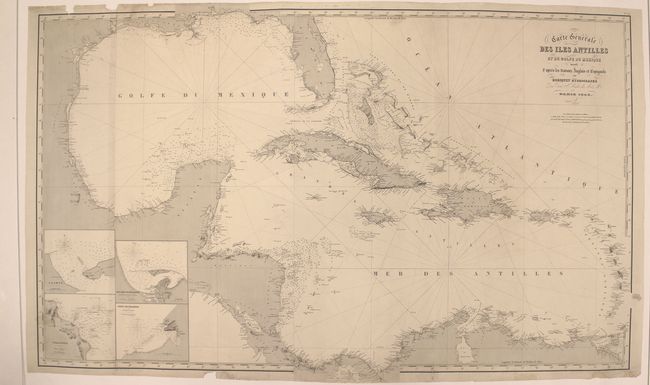
Subject: Gulf of Mexico & Caribbean

Period: 1853 (dated)

Publication:

Color: Black & White

Size:
45.7 x 28.1 inches
116.1 x 71.4 cm
Download High Resolution Image
(or just click on image to launch the Zoom viewer)

This large sea chart of the Gulf of Mexico and Caribbean extends as far north as Mobile Bay and as far south as the Gulf of Panama. Place names are provided along the coasts, and depth soundings, bottom types, reefs, rocks, and lighthouses are shown. There are four insets at bottom left, illustrating the same sort of navigational details: Carmen, Veracruz, San Juan de Nicaragua, and Port de Chagres. On 2 joined sheets.

References:

Condition: B+

A crisp impression with light soiling and small damp stains. Mounted on heavy canvas to repair numerous small chips and edge tears, the longest of which enters 1" into the image.

Estimate: $140 - $180

Sold for: $100

Closed on 11/19/2014

Archived