Subject: Puget Sound
Period: 1866 (dated)
Publication:
Color: Black & White
Size:
25.2 x 27.1 inches
64 x 68.8 cm
The Office of Coast Survey is the oldest U.S. scientific organization, dating from 1807 when Congress directed that a "survey of the coast" be carried out. By 1836, it was called the U.S. Coast Survey and in 1878, the name was changed to the U.S. Coast and Geodetic Survey. Today the Office of Coast Survey is a division of the National Oceanic and Atmospheric Administration NOAA.
The survey teams, composed of civilians as well as Army and Naval officers, charted the nation's waterways and produced a wide array of reports, survey charts, hydrographic studies of tides and currents, astronomical studies and observations, and coastal pilots. These charts are an important record of the changing nature of the nation's coastlines. In additional to coastal charts, the U.S. Coast and Geodetic Survey produced land sketches, Civil War battle maps, and the early aeronautical charts.
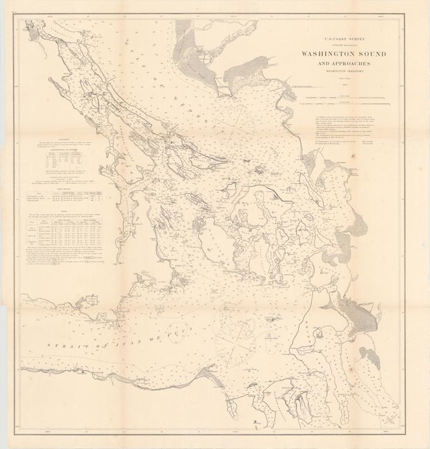
This chart details the area centered on the San Juan Islands and is filled with soundings, two magnetic variation roses, and other sailing information. Notes at left give additional information on soundings, light houses, and tides. Extends to show Whidbey Island with only two towns: Taftsonville and Coveland. The Strait of Juan de Fuca extends westward to beyond the Port Angelos, Ediz Hook, Observatory Pt., and Low Pt. A handsome chart that extends north into British Columbia to show the mouth of the Frazer River and Gabriola Island.
References:
Condition: B
Issued folding with a number of fold separations, all of which have been closed with archival tape. There are some minor spots, faint toning along the folds, and creasing at right and left.