Subject: Texas
Period: 1848 (circa)
Publication: A New Universal Atlas…
Color: Hand Color
Size:
12.8 x 10.7 inches
32.5 x 27.2 cm
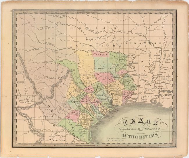
According to Rumsey, this map comes from a rare 1848 reissue of Greenleaf’s 1842 Universal Atlas. Greenleaf's earlier 1842 map of Texas, which is nearly identical to this example, was based upon Burr’s map of 1833 (which was the first to show the territorial claims that would eventually become the Republic). Texas is now part of the United States with the only update being the southern border now shown along the Rio Grande (the earlier edition conservatively had the border along the Nueces River) and the addition of San Patricio county. Development is confined to areas to the east of San Antonio and Austin, with the areas to the west void of detail except for the river system. Portions of Indian Territory, Arkansas and Louisiana are also shown.
References: Rumsey #2866.064; cf. Phillips #784; cf. Day #1404.
Condition: A
A nice impression with a few tiny edge tears and chips confined to the blank margins and minor toning along the top of the sheet.