Subject: Texas
Period: 1835 (published)
Publication: A Comprehensive Atlas Geographical, Historical & Commercial
Color: Hand Color
Size:
10.4 x 8.9 inches
26.4 x 22.6 cm
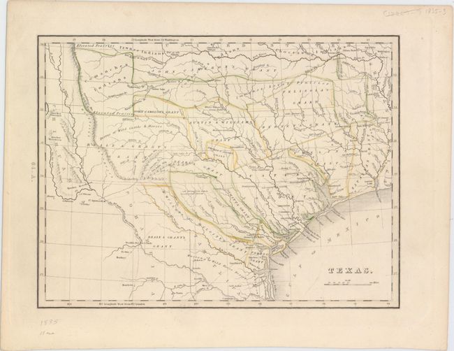
This important map comes from Bradford's Comprehensive Atlas, which is the first American atlas to contain a separate map of Texas. It is based upon Stephen F. Austin’s important map and shows land grants instead of counties. There are 14 total land grants including Beales Grant, Austin & Williams Grant, and DeWitts Grant to name a few. Austins Colony is also named, but the city of Austin does not appear. The Nueces River is designated as the southwestern boundary of Texas with the "Mustang or Wild Horse Desert" spanning the region between the Nueces and Rio Grande rivers. The map is marked page 64.A., and is accompanied by two pages of text marked 64.B and 64.C. describing the physical features, and also points out that Texas is "at present engaged in an arduous struggle for independence." Later editions only include one page of descriptive text.
References: Martin & Martin #31; Taliaferro #248; cf. Phillips (A) #770.
Condition: A+
A clean and bright example with original outline color.