Subject: Gettysburg, Pennsylvania, Civil War
Period: 1883 (dated)
Publication:
Color: Printed Color
Size:
27.6 x 29 inches
70.1 x 73.7 cm
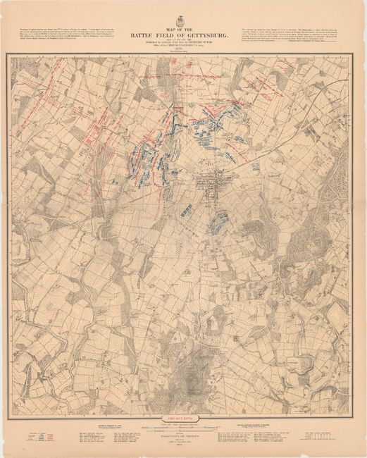
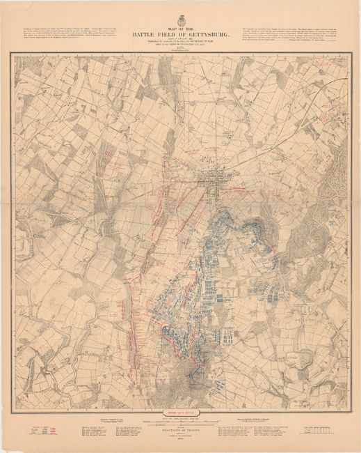
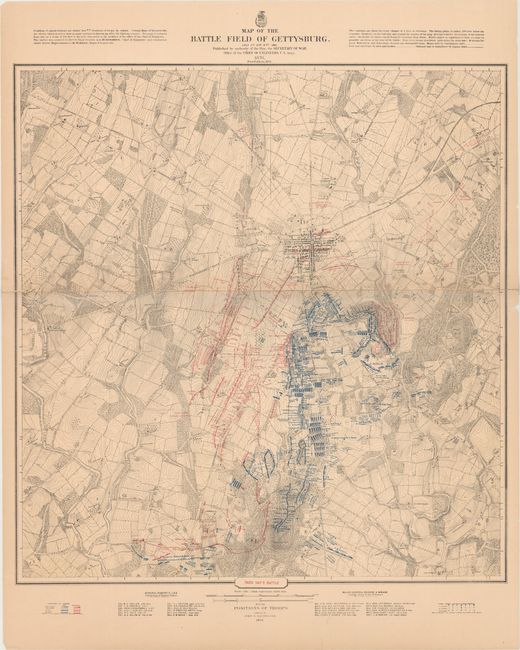
This scarce and desirable set is the ultimate for students of the Battle of Gettysburg. These are extremely detailed topographic maps with spot elevations and contours for every change of four feet in elevation. Details include drainage, vegetation, roads, railroads, fences, houses with names of residents, and a plan of the town of Gettysburg. Notes at upper right indicate that "Every object is represented here as near as possible as it was at the time of the battle." A detailed analysis of the deployment of the various units of both armies, with the names of commanding officers, period of time spent in a particular position, and other pertinent information is given. Dotted lines and arrows indicate troop movement and their positions at various times of the day. This is Bachelder's edition of 1883 which carries no statement of publication, printing or engraving.
References: Stephenson #326.
Condition: B+
The maps are overall very good, but printed on very thick paper which resulted in several long splits of the linen backing along the horizontal fold, now closed on verso with archival tape. Faint toning with occasional chips and edge tears confined to the blank margins.