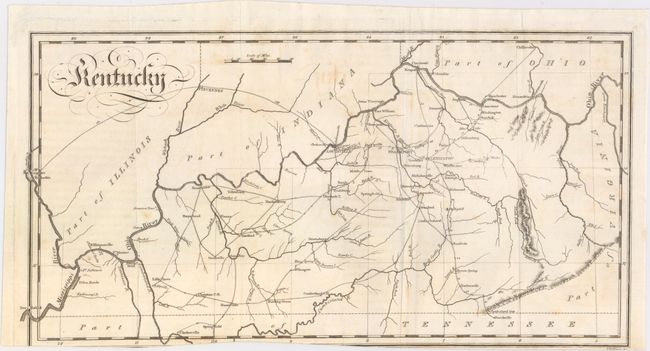
Subject: Kentucky
Period: 1812 (circa)
Publication: Travels in the United States...
Color: Black & White
Size:
14.6 x 7.5 inches
37.1 x 19.1 cm
This early copper engraved map details towns and villages, watershed, topography, and wagon roads. Several of the roads show distances between towns including a long, arched road from Louisville to Kaskaskia, Illinois. The Cumberland Gap is located, and the eastern boundary of the state is shown following the west fork of the Big Sandy River instead of the east fork. An uncommon state map not including Tennessee.
John Melish was the first American publisher to concentrate on cartographic and geographic publications. Born in Scotland, Melish immigrated to Philadelphia in 1811. In 1812 he published Travels in the United States of America, which included his first maps. He soon came to dominate the industry in this country, and had a huge impact on all subsequent American map-making.
References:
Condition: B
A nice impression with a bit of offsetting, a few small spots, and a tiny portion of the lower neatline missing due to an uneven binding trim.