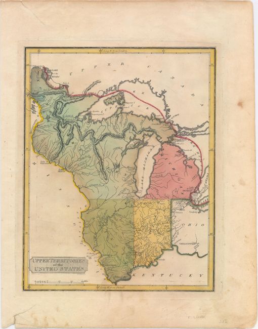
Subject: Upper Midwestern United States
Period: 1816 (published)
Publication: A New and Elegant Atlas…
Color: Hand Color
Size:
8.5 x 10.8 inches
21.6 x 27.4 cm
This map depicts the old Northwest Territory showing the state of Ohio along with Indiana, Illinois, Michigan and Northwestern Territory. Indiana would achieve statehood later in the publication year. Detroit is shown with its Canadian neighbor, Windsor, named Sandwich, but there is no Chicago. Several frontier forts are located, but much of the territory still appears unsettled. The apocryphal mountain ridges are the most prominent topography on the map and the fictitious Phillipeaux Island remains in Lake Superior. Engraved by H.S. Tanner.
References: Phillips (A) #3542-54.
Condition: B+
Original color with light soiling and a few edge tears closed on verso with archival tape.