Subject: Tennessee, Kentucky
Period: 1839-41 (dated)
Publication: New Universal Atlas
Color: Hand Color
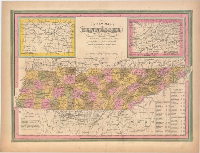
A. A New Map of Tennessee with its Roads and Distances from Place to Place Along the Stages & Steam Boat Routes, dated 1841 (14.4 x 10.5"). This is the uncommon Tanner issue of this map; one of the few 19th century maps to show Tennessee alone. The map is inset with the regions surrounding both Nashville and Knoxville at the top, and the steamboat routes all the way to New Orleans are noted in a table to the right. Samuel Augustus Mitchell, and then Thomas, Cowperthwait & Co. purchased the plates for their editions of the Universal Atlas, but it is the earlier Tanner editions that are much more sought after.
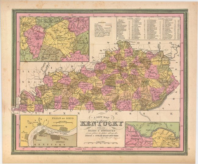
B. A New Map of Kentucky with its Roads & Distances from Place to Place Along the Stage & Steam Boat Routes, dated 1839 (13.0 x 10.7"). This highly detailed map of Kentucky illustrates roads and distances along the stage and steamboat routes. Canals, railroads, the state capital, county towns and leading roads are noted. Includes insets of Falls of Ohio, the vicinity of Clarksburg and Maysville, and the vicinity of Lexington. This is one of a few 19th century maps to show Kentucky without Tennessee.
References:
Condition: B+
Original color with a few minor spots in the image and light toning along sheet edges.