Subject: Eastern United States
Period: 1860 (circa)
Publication: Atlas of the World
Color: Hand Color
Size:
10.8 x 8.6 inches
27.4 x 21.8 cm
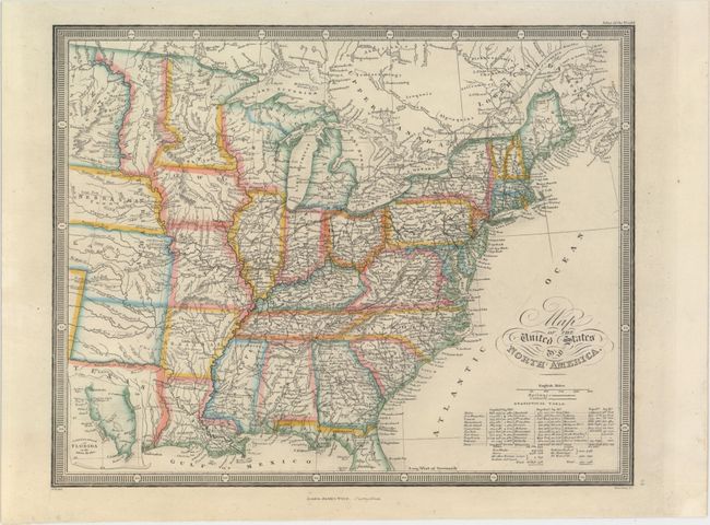
This detailed map shows the United States from the Midwest east, with a little of Canada depicted as well. Plenty of towns and cities, rivers, railways, canals, lakes, and Indian tribes are identified. Indian Territory or present-day Oklahoma is just an unnamed square beneath Kanzas, which appears here in territorial configuration just prior to becoming a state. Dacota is merely a narrow territory between the Missouri River and Minnesota. West Virginia has not yet broken away from Virginia. An inset at bottom left features the southern tip of Florida on the same scale as the rest of the map. Beneath the title is a table of statistics with the populations of the various states and territories as well as total US population broken down by race. The total population comes out to be 47,838,226, plus 471,136 Indians. Engraved by Stockley. Wyld's Atlas of the World was first published in 1836 with several editions published through the mid-1860's.
References:
Condition: A
A couple insignificant spots, else fine.