Subject: United States, Civil War
Period: 1861 (circa)
Publication:
Color: Hand Color
Size:
16.9 x 10.8 inches
42.9 x 27.4 cm
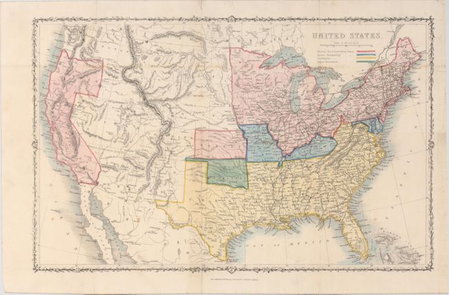
This great Civil War map covers the entire United States and depicts the Union states, Confederate states, border states and Indian Territory. A large section from Texas to California is left uncolored with the Missouri Compromise line following the 36th parallel in this region. Arizona is shown occupying the southern section of New Mexico territory, likely referencing the Confederate Territory of Arizona. The detailed map shows railroads, rivers and topography via hachure. Published by London Printing & Publishing.
References:
Condition: B+
Issued folding with a few spots of foxing, minor toning, and a short binding tear that just passes the neatline at right closed on verso with archival tape.