Subject: Colonial Eastern United States & Canada
Period: 1763 (published)
Publication: Gentleman's Magazine
Color: Hand Color
Size:
9.2 x 8 inches
23.4 x 20.3 cm
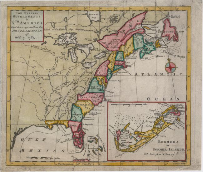
This great map was designed to illustrate the new boundaries established at the end of the French and Indian War when England came into possession of the former French and Spanish settlements in Canada and Florida. It covers the east coast from Newfoundland down the coast to East and West Florida, the Bahamas, inland including the Great Lakes and French Louisiana. The large Lands Reserved for the Indians lies west of the Appalachians. Each colony is shown with a wide engraved line. Large inset illustrates Bermuda or Summer Islands. Compass rose with the fleur-de-lis decorate the strong engraving.
References: Fite & Freeman #55; Jolly #GENT-170; McCorkle #763.3; Sellers & Van Ee #110.
Condition: B
Originally issued folding, now flat, with light soiling, a few short archivally repaired tears and fold separations, and some tiny worm holes that are only visible when held up to light.