Subject: Exploration and Surveys
Period: 1967 (published)
Publication:
Color: Black & White
Size:
8 x 10.2 inches
20.3 x 25.9 cm
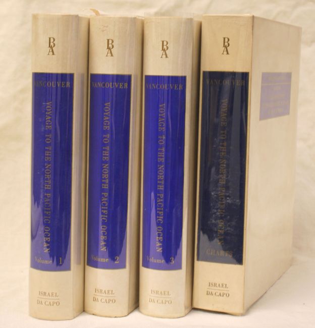
This is a facsimile of the account of the Vancouver Expedition (1791-95) originally published in 1798. During the summers of 1792-94, George Vancouver and the crew of the British naval ships Discovery and Chatham mapped the northwest coast of North America from Baja California to Alaska. Vancouver's voyage was the last, and longest, of the great Pacific voyages of the late eighteenth century. Taking the art and technique of distant voyaging to a new level, Vancouver eliminated the possibility of a Northwest Passage and his remarkably precise surveys completed the outline of the Pacific. His expedition was also partially responsible for the British domination of Australia and New Zealand and the establishment of the Kingdom of Hawaii through his assistance to Kamehameha I, the king of Hawaii. The first three volumes in the set consist of text and 18 plates detailing the voyage, while the fourth volume is a clamshell containing 16 folding charts, 12 of which focus on mapping the northwest coast of North America. The set's four volumes form entries #30 through #34 in Nico Israel and Da Capo Press' 75 volume Bibliotheca Australiana series. Hardbound in simulated vellum featuring blue title plates on cover and spine with gilt lettering.
References:
Condition: B+
The charts are in fine condition. Contents of the three text volumes are good except for some faint toning along the sheets' edges. There is some light soiling along the edges of the covers. The clamshell is slightly warped and there are two small pieces of tape inside.


