Subject: Papua New Guinea
Period: 1798 (circa)
Publication: Atlas du Voyage de Bruny-Dentrecasteaux en 1792 et 1793
Color: Black & White
Size:
29.8 x 19.6 inches
75.7 x 49.8 cm
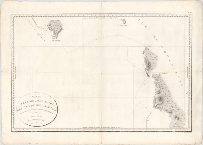
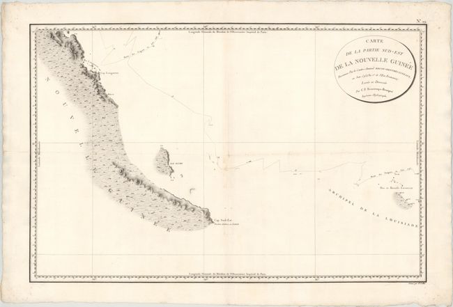
This elegant pair of charts shows parts of Papua New Guinea that Antoine Bruni d'Entrecasteaux traveled on his search for La Perouse in 1792 and 1793. Both charts feature excellent topographical detail of the islands' coastlines. Engraved by E. Collin.
A. Carte de la Partie Septentrionale des Iles de Bougainville Reconnue par le Contre-Amiral Bruny-Dentrecasteaux, en Juillet 1792, (29.8 x 19.6"). This chart spans from the southern tip of Latangai Island (here called New Ireland) to the northwest coastline of Bougainville Island. Bruni d'Entrecasteaux's route is traced and dated July 1792. Condition: Faint soiling, a few miniscule worm holes only visible when held up to light, and an extraneous horizontal crease. There is a small, archivally repaired split in the map's center and centerfold separations at top and bottom, confined to the blank margins.
B. Carte de la Partie Sud-est de la Nouvelle Guinee Reconnue par le Contre-Amiral Bruny-Dentrecasteaux, en Juin 1793 (An 1er. de l'Ere Francaise), (29.3 x 19.3"). This chart follows Bruni d'Entrecasteaux's track from the Louisiade Archipelago (named for Louis XV by Louis Antoine de Bougainville) up the southeastern coastline of Papua New Guinea in June 1793, just a month before the explorer died of scurvy. After his death, the expedition ended in the East Indies amid open clashes between the Royalists and the Republicans in the crew. Condition: A dark impression with two small pairs of worm holes, the larger of which has been closed on verso using archival materials. There is minor soiling and an extraneous horizontal crease.
References:
Condition: B+
See description above.


