Subject: Southern Africa
Period: 1703 (circa)
Publication:
Color: Hand Color
Size:
13.8 x 11 inches
35.1 x 27.9 cm
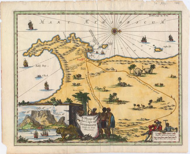
A striking map of the Cape of Good Hope showing an inventive inset of Table Bay at the lower left. The interior of the map is filled with elephants, a rhinoceros, lion, ostriches, snakes, and several other species. A road stretches from Table Bay to the interior. A dotted line between Table Bay and False Bay represents a proposed canal that was not undertaken, and a notation of Very Good Grounds refers to the land granted to the first free burgher on the Cape. The sea is filled with ships, and a compass rose orients north to the right of the map. The title is on a hide held by a group of natives while a lion stalks the foreground. The scale of miles cartouche is attended by a Dutchman and a young African with surveying equipment.
References: Norwich #209.
Condition: A
A crisp impression on watermarked paper with some chips and edge tears in the blank margins, well away from image.


