Subject: Northwestern Africa
Period: 1875 (dated)
Publication:
Color: Hand Color
Size:
73.1 x 40 inches
185.7 x 101.6 cm
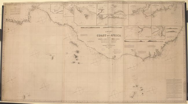
This large blue-backed sea chart is on 3 joined sheets and covers the Atlantic Ocean from the southern edge of Portugal and Spain down the African coast to Liberia. There is a great deal of hydrographical information, including soundings, compasses, currents, lighthouses (marked with red and yellow), various paragraph-long navigational notes, and more. Islands such as the Azores, Madeira, Canary, and Cape Verde also appear. In addition to 6 land approach views, there are also 12 insets running along the top of the chart: Mazaghan, Rabat and Sale, Mogador, Goree Bay, Entrance to the Cazamance, Isle de los Anchorage, River Senegal, Approach to the River Gambia, The Coast in the Vicinity of Sierra Leone, Sketch of Portendik, Agadir of Sta. Cruz, and Sierra Leone. North is oriented to bottom left. The chart was based on the latest surveys of the coast, which occurred over 40 years before publication, from 1822 to 1835. A blue "Imray & Son London 1876" stamp appears below the title.
References:
Condition: B+
Overall very good condition with original color (red and yellow) on lighthouses, light soiling, and scattered foxing.


