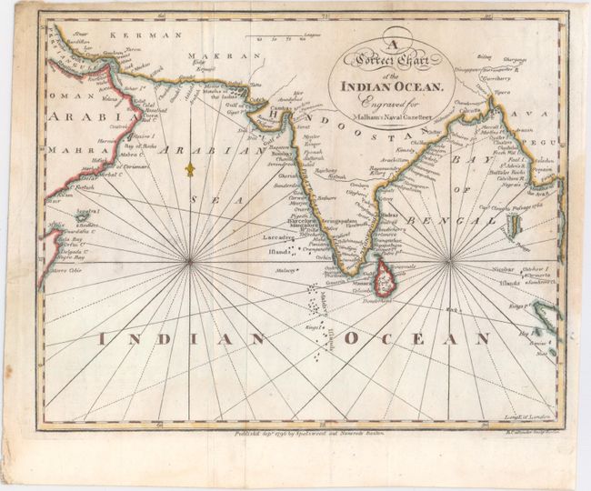
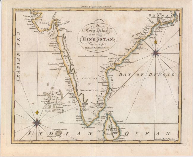
Subject: Indian Ocean
Period: 1797 (published)
Publication: Malham's Naval Gazetteer
Color: Hand Color
Size:
9.1 x 7.3 inches
23.1 x 18.5 cm
Two small and detailed charts of the Indian Ocean depicting parts of Arabia, India, Sri Lanka, and the Maldive Islands. The charts locate numerous places along the coasts, and label major cities and regions such as Calcutta, Chennai (as Madras or Ft. St. George), Mangalore, Bombay, Hindostan, and Mysore. Three compass roses with radiating rhumb lines fill the seas. The charts were engraved for Rev. John Malham (1747-1821), a writer and teacher of navigation, for an American edition of Malham's The Naval Gazetteer; or, Seaman's Complete Guide.
A. A Correct Chart of the Indian Ocean. Engraved for Malham's Naval Gazetteer. Condition: Issued folding with a few faint damp stains, a couple mis-folds, and a 1.5" edge tear at left that has been repaired with archival materials.
B. A Correct Chart of the Coasts of Hindostan. Engraved for Malham's Naval Gazetteer. Condition: Light scattered foxing.
References: McCorkle (18th C. Geography Books) #253, Vol. II #2 & #5.
Condition: B+
See description above.