Subject: Central Myanmar
Period: 1775 (circa)
Publication: Le Neptune Oriental
Color: Black & White
Size:
19.1 x 13.1 inches
48.5 x 33.3 cm
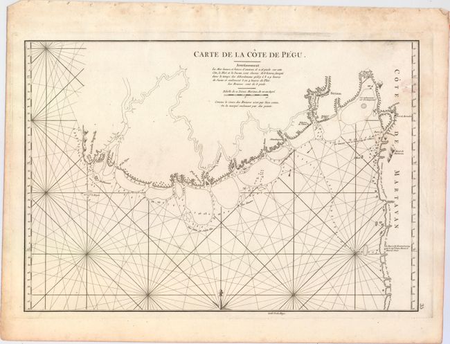
This uncommon chart covers the region in south central Myanmar from the Irrawaddy Delta through parts of the Yangon, Bago, and Mon regions. A few towns are located inland, including Thanlyin (Siriam) and Mottama (Martaban), and the courses of various rivers are provisionally traced. A few mountains are depicted, as are a number of trees (among them some palms) along the coast. Soundings, hazards, shoals, anchorages, and notes on the currents and bottom types appear in a sea crossed with rhumb lines. A lengthy note along the coast of the Mon State claims that little is known of the area. Engraved by Guillaume Nicolas Delahaye.
A French sailor and hydrographer, D' Après de Mannevillette (1707-1780) used new instruments to correct the latitudes measured by previous explorers. His atlas Le Neptune Oriental, first published in 1745, was considered a major achievement and an indispensable resource for navigators.
References: Shirley (BL Atlases) M.APR-1c.
Condition: B+
A sharp impression on a sturdy, watermarked sheet with a damp stain at top right. There are binding holes along the sheet's top edge, outside the image.