Subject: Middle East
Period: 1640 (circa)
Publication:
Color: Hand Color
Size:
20.3 x 17 inches
51.6 x 43.2 cm
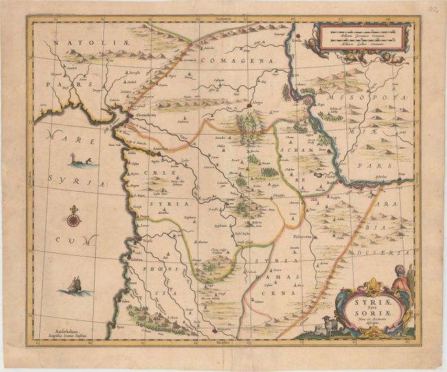
Handsome map of Syria and Lebanon, fully engraved with mountain ranges, forests and cities. Damascus is at the bottom of the map and Edessa (Sanliurfa) is at the top. The coastal cities include Alexandria, Antioch, Tyro, Tripoli, Sidon, and Curco. The map is embellished with a fine strapwork title cartouche flanked by a shepherd and his flock, a scale of miles held aloft by three cherubs, a sailing ship, compass rose and a sea monster. No text on verso.
References: Van der Krogt (Vol. I) #8140:1.
Condition: B
A dark impression on a sheet that has been professionally backed with tissue to repair one small hole at bottom center and three tears that enter 2-3" into the map at top and bottom near the centerfold. The bottom left corner margin has been restored. The map still presents well.


