Subject: Eastern Czech Republic
Period: 1645 (dated)
Publication:
Color: Hand Color
Size:
21.4 x 17.5 inches
54.4 x 44.5 cm
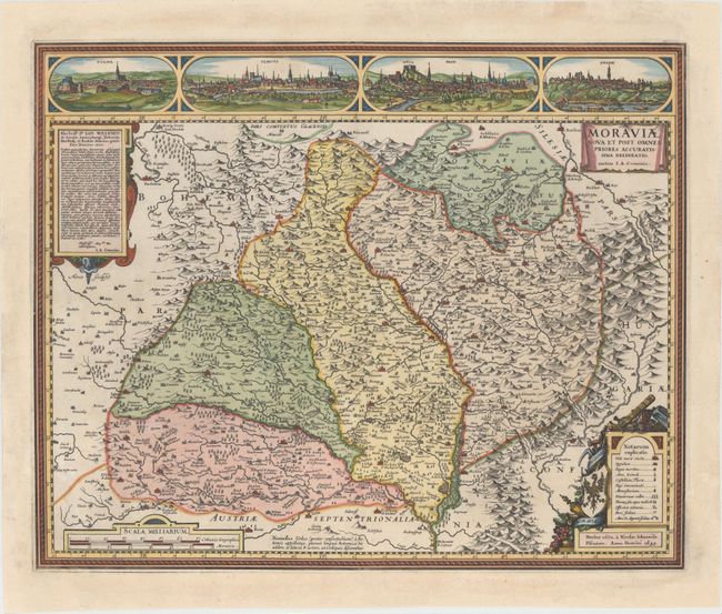
Handsome map of Moravia based on the work of Johan Amos Comenius (1592-1670), a Czech educator and bishop. The map is filled with detail of the cities, rivers, mountains and forests and is adorned with four cartouches filling each of the corners. Above the map are lovely views of four cities: Polna, Olmuts (Olomouc), Brin (Brno) and Znaim (Znojmo). Visscher's Latinized name, Nicolao Johannide Piscatore, appears below the legend. Engraved by Abraham Goos, although his imprint does not appear on the map. This is the fourth of seven states, first published in 1627.
References: Schilder (Monumenta Cartographica Neerlandica, Vol. VI) #48.4.
Condition: A
Excellent impression and color with numerous chips in blank margins that have been professionally repaired. Two chips just enter the neatline at left and in the top right corner, with a very minor portion of the neatline expertly replaced in facsimile.


