Subject: Western Germany
Period: 1681 (dated)
Publication: Atlas Nouveau...
Color: Hand Color
Size:
22.4 x 17.1 inches
56.9 x 43.4 cm
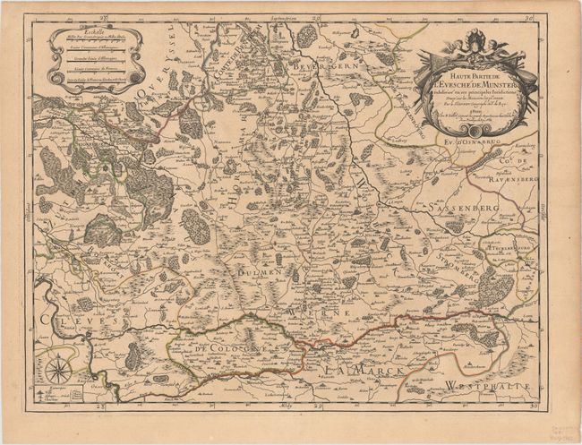
This elegant map essentially covers the northern part of the present-day state North Rhine Westphalia in Germany. It centers on the city of Munster and includes numerous political divisions, towns and cities, forests, rivers (including the Rhine, Lippe, and Ems), and other topographical details. There are two decorative cartouches in the top corners of the map: the one at left encasing five distance scales, and the one at right for the title, embellished with putti and symbols of the region's might. A compass rose adorns the bottom left corner with a key beneath it identifying cities, abbeys, and castles.
References: Pastoureau, JAILLOT I C #75.
Condition: B+
A dark impression on a sturdy and lightly toned watermarked sheet.