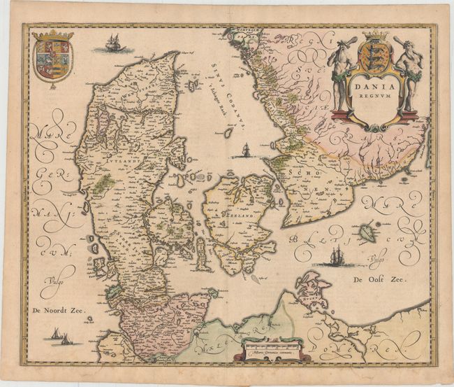
Subject: Denmark
Period: 1643 (circa)
Publication: Theatre du Monde ou Nouvel Atlas
Color: Hand Color
Size:
20.6 x 16.8 inches
52.3 x 42.7 cm
This is a large, attractive map of Denmark and southern Sweden with good detail throughout. Skaneland, the historical region at the southern tip of the Scandinavian peninsula, is part of Denmark here, as the map was not updated to reflect the region's return to Sweden after the 1658 Treaty of Roskilde. The map is adorned with five sailing ships and a title cartouche featuring the Danish coat of arms supported by the traditional woodwoses. French text on verso, published between 1643-50.
References: Van der Krogt (Vol. II) #1500:2.
Condition: A
A nice impression with original color that has been partially refreshed. There are faint damp stains that just enter map border at bottom, and an archivally repaired centerfold separation in top blank margin.


