Subject: Ireland
Period: 1836-60 (circa)
Publication:
Color: Hand Color
Size:
9.4 x 13.4 inches
23.9 x 34 cm
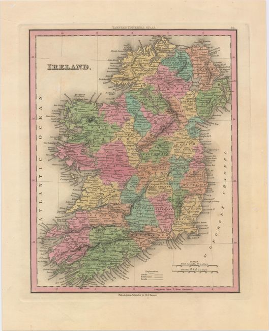
A. Ireland, by Henry Schenck Tanner, from Tanner's Universal Atlas, circa 1836 (8.9 x 11.2"). This handsome map of Ireland shows the nation divided into counties. Roads, canals, and railroads are identified in addition to the many towns and cities, rivers, and lakes shown. There is excellent detail along the coastline as well, with bays, harbors, ports, and islands noted. A lighthouse appears near Dublin. Condition: Minor soiling, otherwise fine. (A)
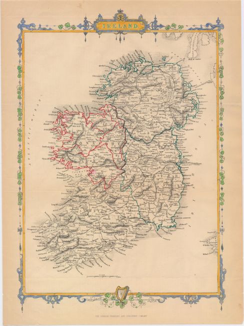
B. Ireland, by John Rapkin, circa 1860 (9.4 x 13.4"). This intricately detailed map of Ireland emphasizes the four provinces of Ulster, Connacht (here spelled Connaught), Leinster, and Munster. It also features excellent coastal and topographical detail and locates counties, towns and cities, and railroads. A couple submarine telegraph lines can be found around Belfast Lough and Dublin Bay. These lines were first installed in 1853 and allowed Ireland to transmit telegrams across the Irish Sea to Great Britain. The beautifully engraved border is comprised of shamrocks, with a harp entwined in shamrocks at the bottom. This is a later edition of the similar Tallis map, with updates and no vignettes, published by the London Printing and Publishing Company. Condition: Issued folding with a 2" tear in an unengraved area at right that has been closed on verso with archival tape. There are a few small chips and short edge tears, one of which enters into the border, and light toning mostly confined to the blank margins. (B+)
References:
Condition:
See description above.