Catalog Archive
Auction 150, Lot 42

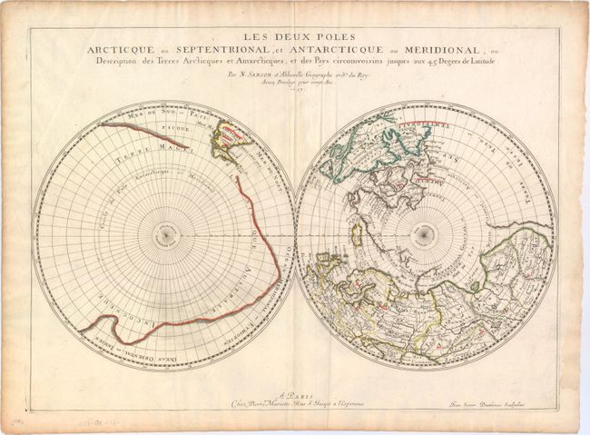
"Les Deux Poles Arcticque ou Septentrional, et Antarcticque ou Meridional, ou Description des Terres Arcticques et Antarcticques; et des Pays Circomvoisins Jusques aux 45 Degres de Latitude", Sanson/Mariette
Subject: Polar

Period: 1657 (dated)

Publication: Cartes Generales de Toutes les Parties du Monde

Color: Hand Color

Size:
21 x 15.3 inches
53.3 x 38.9 cm
Download High Resolution Image
(or just click on image to launch the Zoom viewer)

The extent of polar explorations is the focus of this unusual map of the north and south poles. In the Northern Hemisphere, Greenland is depicted attached to the American continent, and three large islands comprise the Canadian Arctic. It is hinted that Terre de Yezo, ou Iesso takes up the entire North Pacific region between Buttons Bay and East Asia. In the Southern Hemisphere, the tip of South America is shown with the Strait of Magellan and Le Maire Strait. The balance of the map is filled with a large landmass labeled Terre Magellanicque, Australe, et Incogneue. Engraved by Jean Somer Pruthenus. This is the first state.

For more information on the partnership between Nicolas Sanson and Pierre Mariette, click here to read the article from our August 2014 Newsletter.

References: Kershaw #144, Pastoureau, SANSON V A #97.

Condition: A

Original outline color on watermarked paper with marginal soiling, remnants of hinge tape on the verso, and a damp stain in the right blank margin, outside the neatline.

Estimate: $600 - $800

Sold for: $400

Closed on 9/17/2014

Archived