Subject: Britain
Period: 1808-66 (circa)
Publication:
Color: Hand Color
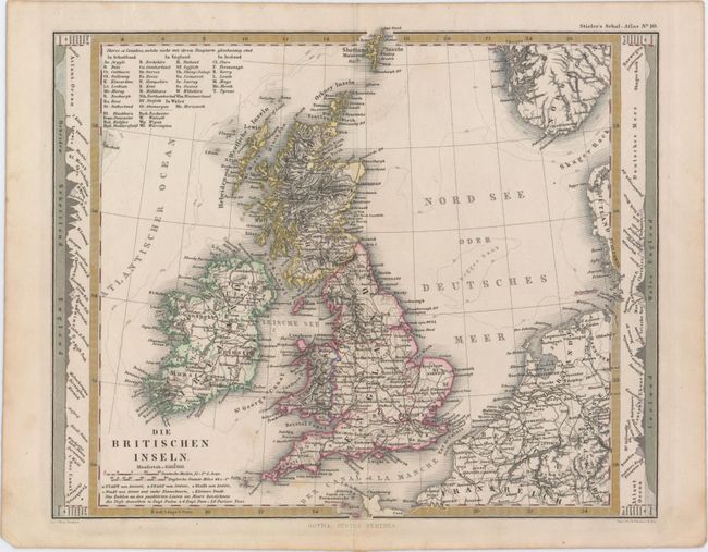
A. Die Britischen Inseln, by Justus Perthes, from Stieler's Schul-Atlas, circa 1866 (10.5 x 8.6"). This attractive map of the British Isles comes from a German school atlas. It extends from the Shetland Islands and part of Norway in the north to the Channel Islands in the south. There is good topographical detail and several towns and cities shown, as well as a key at top left that helps to identify the many counties in Scotland, England, Wales, and Ireland. Charts at left and right outside the map image compare the elevations of various mountains on the Isles. Condition: Minor soiling. (A)
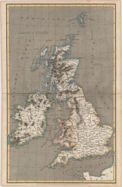
B. British Isles, by Aaron Arrowsmith, dated 1808 (9.8 x 15.9"). This handsome map of the British Isles features towns, cities, rivers, and topographical detail. A number of the smaller islands in the area are identified. Engraved by Cooper and published by Longman, Hurst, Rees, and Orme. Condition: A dark impression with light scattered foxing and some minor toning confined to the blank margins. (B+)
References:
Condition:
See description above.