Subject: North Atlantic
Period: 1728 (circa)
Publication: De Nieuwe Groote Lichtende Zee-Fakkel
Color: Black & White
Size:
23.6 x 20.1 inches
59.9 x 51.1 cm
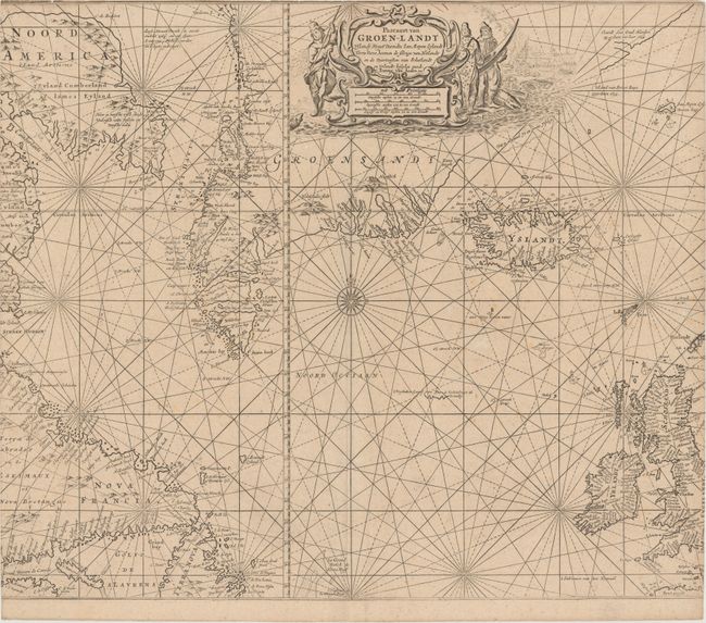
A boldly engraved chart of the northern Atlantic extending from Newfoundland, Labrador and the UK in the south, to Baffin Island, Greenland, Iceland and Jan Mayan Island in the north. This is the scarce later edition with extensive additional information in Canada and Greenland. The coastlines are filled with place names, but inland detail is limited to a few mountains. Numerous small islands and fishing banks have also been added, including Resolution Island. In Baffin Island (here called Eyland Cumberland and Iames Eyland) there is a notation that translates as: "Here is fresh fish, dead whales, white foxes and fresh salmon." A partial outline continues to the northeast of Greenland with a notation that the area is comprised of ice and large icebergs. Even further north are notations of discoveries of land by Gaal Hamkes in 1654 and Broer Ruys in 1655. The decorative cartouche is surrounded by native hunters and a whaling scene.
References: Tooley (MCC-71) #392.
Condition: B
There are a few tiny holes around the title cartouche and some very light foxing. Trimmed to neatlines at top, left and right, with loss of about 1/8" of image at right and left.