Subject: Canary Islands
Period: 1746-64 (circa)
Publication:
Color: Hand Color
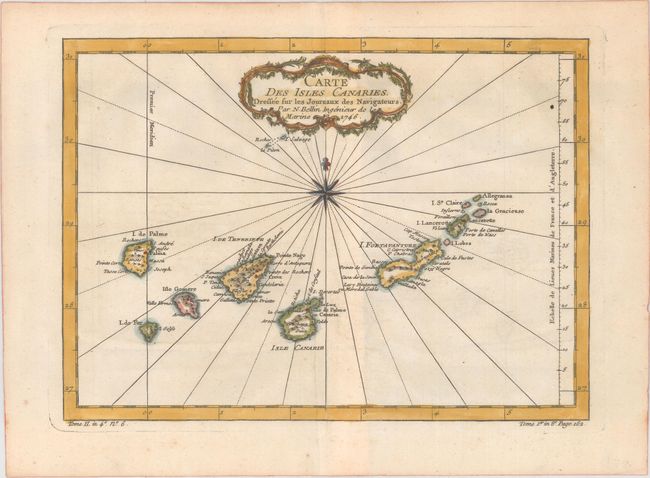
A. Carte des Isles Canaries. Dressee sur les Journaux des Navigateurs, from Prevost's Histoire Generale des Voyages, dated 1746 (11.2 x 8.1"). This attractive map shows these important Atlantic islands off the northwest coast of Africa in nice detail. Numerous towns are located and the mountains of the islands are well rendered. Includes a delicately engraved French-style title cartouche, compass rose capped with fleur-de-lis, and rhumb lines. Condition: On a watermarked sheet with a hint of offsetting and a few light creases.
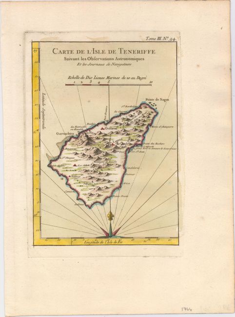
B. Carte de l'Isle de Teneriffe Suivant les Observations Astronomiques et les Journaux de Navigateurs, from Le Petit Atlas Maritime , circa 1764 (5.9 x 8.2"). This small chart focuses on Tenerife, the largest of the Canary Islands. It features nice topographical detail and names several towns including Santa Cruz de Tenerife (here Se. Croix) and San Cristobal de La Laguna (here just Laguna). There are three anchorages and notes on Fort St. Jean and gold mines in the northern mountains. Half a compass rose topped with a fleur-de-lis radiates rhumb lines at bottom. Condition: A fine impression on a sturdy sheet.
References:
Condition: A
See description above.