Subject: Martinique
Period: 1753 (dated)
Publication: Atlas Ameriquain Septentrional...
Color: Hand Color
Size:
24.9 x 19.6 inches
63.2 x 49.8 cm
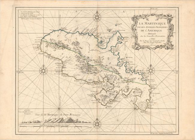
This striking chart of Martinique divides the island into two sections: Cabes Terre and Basse Terre. There is excellent detail of the mountainous terrain inland, but most of the information is concentrated along the coasts, where various capes, forts, cul-de-sacs, rivers, anchorages, and shoals are located. The capital, Fort-de-France (Le Fort Royal), is prominently displayed. A note in the top left corner addresses the history of the island, and a view at bottom left shows the island as it appears from the vantage of the ocean. Four compass roses topped with fleurs-de-lis and radiating rhumb lines surround the island on all sides.
References:
Condition: B+
Original outline color on a watermarked sheet with light soiling, faint offsetting, and a pair of small worm holes near the centerfold at bottom.