Subject: Haiti
Period: 1764 (circa)
Publication: Le Petit Atlas Maritime
Color: Hand Color
This nice grouping of four engraved charts includes several important ports along the coast of southern Haiti. Most have decorative cartouches, soundings, rhumb lines and fleur-de-lys.
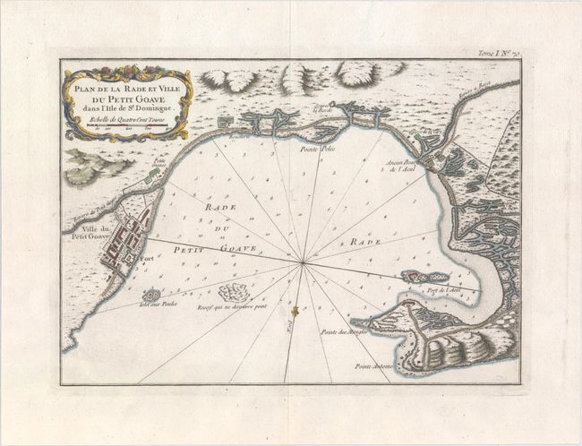
A. Plan de la Rade et Ville du Petit Goave dans l'Isle de St. Domingue, (12.1 x 8.6"). The village of Petit-Goave is shown in a block-style plan and the ancient village of Acul is located. Fortifications are noted on an island and at the tip of Pointe des Mangles. Condition: A hint of offsetting and faint damp stains in the upper blank margin.
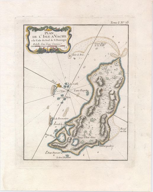
B. Plan de l'Isle a Vache a la Coste du Sud de S. Domingue, (6.5 x 8.5"). This single-page map details the island, surrounding shoals, rocks, islets, and more. Condition: On a watermarked sheet with minor soiling in the blank margins.
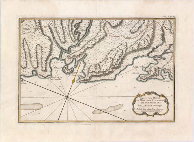
C. Carte des Bayes du Mesle des Flamands et de Cavaillon dans l'Isle de St. Domingue, (13.1 x 8.8"). This chart shows three bays along the belly of the island in excellent topographical detail. Condition: On a watermarked sheet with minor offsetting and faint damp stains in the upper blank margin.
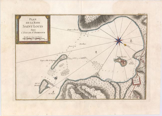
D. Plan de la Baye Saint Louis dans l'Isle de St. Domingue, (13.8 x 8.9"). Locates Fort St. Louis and the Ville de St. Louis and is decorated with nice cartouche compass rose. Condition: On watermarked paper with a small amount of printer's ink residue and faint damp stains in the upper blank margin.
References: Sellers & Van Ee #1882, #1894, #1897, & #1902.
Condition: A
See description above.