Catalog Archive
Auction 150, Lot 294

"Map of Battles on Bull Run, Near Manassas, on the Line of Fairfax and Prince William Counties, in Virginia...",

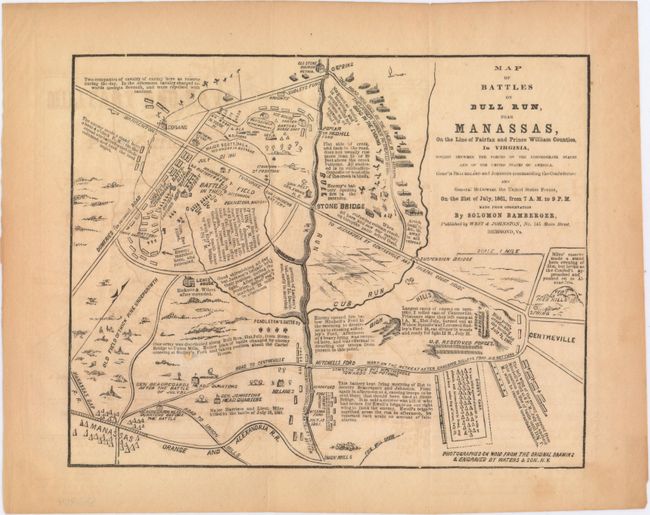
Subject: Northern Virginia, Civil War

Period: 1862 (published)

Publication: The C.S.A. and the Battle of Bull Run

Color: Black & White

Size:
9.2 x 7.3 inches
23.4 x 18.5 cm
Download High Resolution Image
(or just click on image to launch the Zoom viewer)

This small map depicts the Battle at Bull Run which was the first major land battle in Virginia. Highly detailed, the map shows troop positions, battlefields, important buildings and topography. Explanatory notes of the day's action fill the blank spaces. Made from the observations of Solomon Bamberger, drawn and engraved by Waters & Son, and later published by West & Johnson in Richmond. This was one of five maps included in The C.S.A. and the Battle of Bull Run..., written by J.G. Barnard and published by D. Van Nostrand.

The same map appears in the October 11th, 1861 edition of the New York Herald. Click here to see the New York Herald example held at the Library of Philadelphia.

References:

Condition: B+

Issued folding with light toning, offsetting, and two short fold separations confined to the blank margins.

Estimate: $80 - $100

Sold for: $75

Closed on 9/17/2014

Archived