Subject: California
Period: 1855 (circa)
Publication: U.S.P.R.R. Exp. & Surveys, Cal.
Color: Hand Color
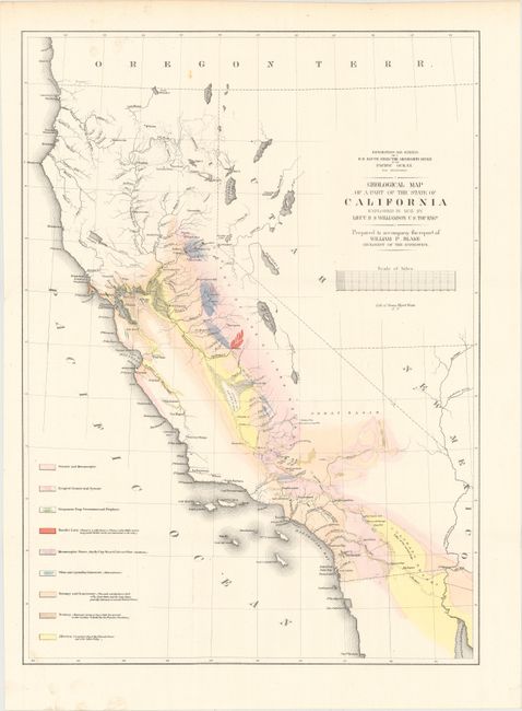
A. Geological Map of a Part of the State of California Explored in 1853 by Lieut. R.S. Williamson U.S. Top. Engr... (16.1 x 22.2"). A majority of this map of California is colored to reflect geological knowledge and coded in accordance with a legend at the left. The legend identifies nine geological units as mapped by Lieut. R.S. Williamson of the Topographical Engineers. There are interesting details throughout, and especially along the American River. A huge Mono Lake is shown, but not Lake Tahoe; rather, in its place is a small lake named Lake Bonpland. In Southern California, Los Angeles, San Gabriel and San Pedro are located. Interestingly, the water between San Pedro (Long Beach) and San Diego is called "Earthquake Bay."
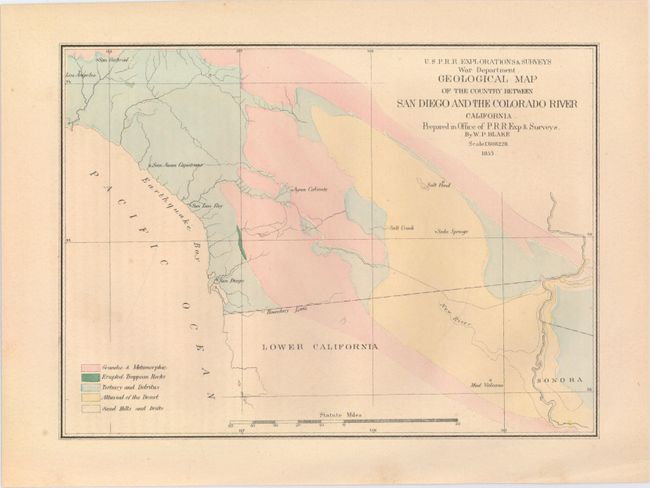
B. Geological Map of the Country Between San Diego and the Colorado River California... (9.3 x 6.8"). This map defines five geological units named in the legend via hand coloring. Showing the region along the border with Mexico, the map locates San Diego, San Luis Rey, San Juan Capistrano, Los Angeles, San Gabriel, and Agua Caliente. The map also names a Salt Pond, Salt Creek, Soda Springs and a Mud Volcano in Mexico.
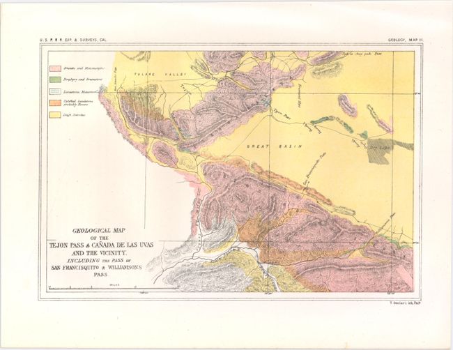
C. Geological Map of the Tejon Pass & Canada de las Uvas and the Vicinity. Including the Pass of San Francisquito & Williamsons Pass (9.3 x 6.3"). Map shows the region to the east of Santa Barbara. Identifies five different geologic types including granite, limestone and sandstone.
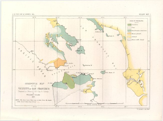
D. Geological Map of the Vicinity of San Francisco... (9.3 x 6.3"). Depicts the entire San Francisco Bay area and is color-coded for six different geologic types including trap, sand and San Francisco sandstone. Names the Presidio, Mission and Alcatraz. The coastline was based upon charts from the U.S. Coast Survey.
References: Marcou & Marcou #671, #676, #678 and #679.
Condition: A
Maps are clean and bright. The San Diego map has light, even toning and a hint of offsetting from an opposing page of text.