Subject: World
Period: 1694 (dated)
Publication: Atlas Royal
Color: Hand Color
Size:
24.3 x 19.5 inches
61.7 x 49.5 cm
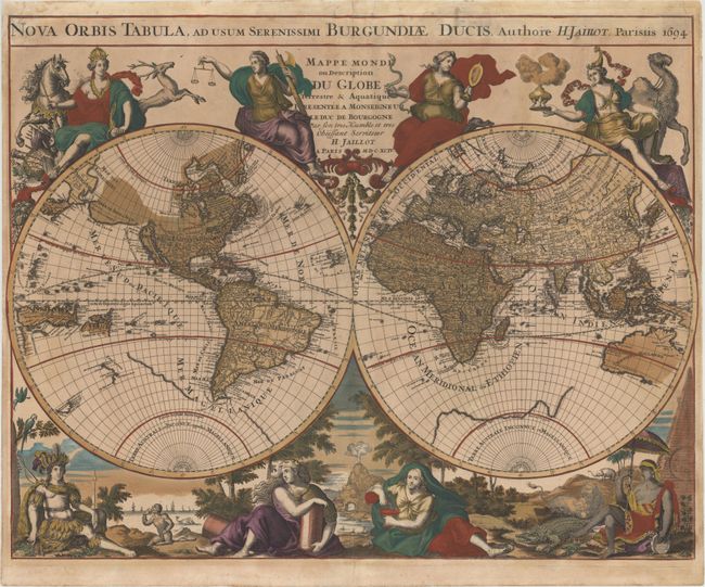
This is the first state of this lavishly decorated double-hemisphere map by Hubert Jaillot, which was published in editions of his Atlas Royal from 1694-99. Both the Latin and French titles dedicate the map to the Duc de Bourgogne, also known as the Dauphin of France. Geographically the two hemispheres are similar to those in Jaillot's larger map first published in 1674. French possessions in North America are labeled Canada ou Nouvelle France. In addition, the northwestern coast of North America is largely blank and the Great Lakes are in early formation. The map still shows numerous cartographic myths, including the island of California, a large Terre de Iesso, and a partial coastline of the great southern continent. Two mythical lakes also still appear in South America: Lac ou Mer de Parime and Lac de Xarayes.
The decorative elements surrounding the hemispheres are entirely and elaborately updated. Above the hemispheres are figures representing governance and the arts, including such symbols as a globe, painter's palette, and the scales of justice. At bottom are four figures representing the continents, surrounded by lush scenery with a volcano, wild animals, and sailing ships.
This map is much less common than Jaillot's other world maps. The interesting cartographic elements and lavish decorative surround make this a very desirable late 17th century map.
References: Shirley #561.
Condition: B
Bold original color with moderate oxidation of the green pigment and light toning. There are professional repairs to a tiny tear and adjacent abrasion in bottom vignette near volcano, with a minute amount of image expertly replaced in facsimile.


