Catalog Archive
Auction 150, Lot 208

"Washington and Oregon", Colton, Joseph Hutchins
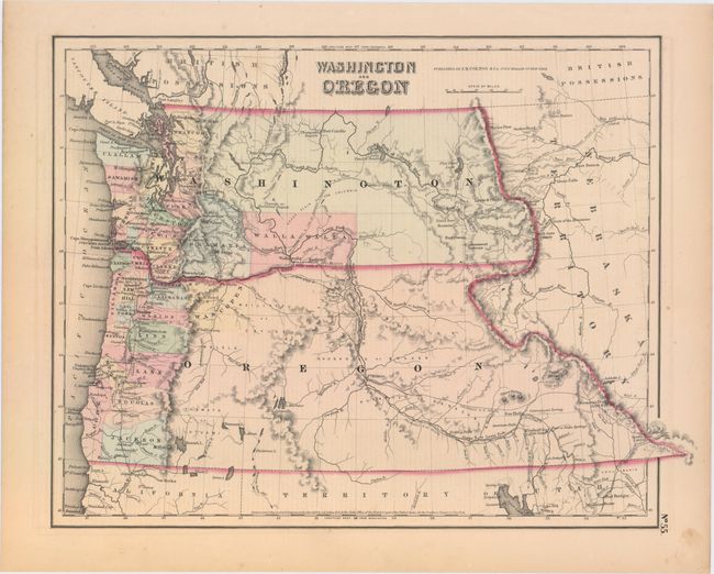
Subject: Northwestern United States, Washington, Oregon

Period: 1853 (dated)

Publication: General Atlas

Color: Hand Color

Size:
14.8 x 11.8 inches
37.6 x 30 cm
Download High Resolution Image
(or just click on image to launch the Zoom viewer)

A great map of the Pacific Northwest showing both territories extending to the Continental Divide and incorporating the region that would become Idaho. Of specific interest is the notation of all the major exploration routes, wagon trails and the proposed routes for the transcontinental railway as explored by Gov. Stevens. A few organized counties are confined to a narrow band along the coast and Wascopen, Skamania and Walla Walla are the only counties east of the Cascade Range. Dated 1853 but published circa 1857.

References:

Condition: A

Very light, even age toning.

Estimate: $180 - $220

Sold for: $100

Closed on 9/17/2014

Archived