Subject: Cartographic Miscellany
Period: 1860 (dated)
Publication: Atlas Spheroidal & Universel de Geographie
Color:
Size:
28 x 21 inches
71.1 x 53.3 cm
A fascinating group of maps from this scarce atlas that is exceptional for its thematic maps and "spheroidal" maps of the world, which have a three-dimensional effect. The popularity of thematic maps reached its zenith in the mid-nineteenth century when advances in printing techniques made possible the production of maps that could clearly display the spatial aspects of physical and cultural phenomena. Sizes vary slightly on sheet size 34 x 24". Included in this lot are:
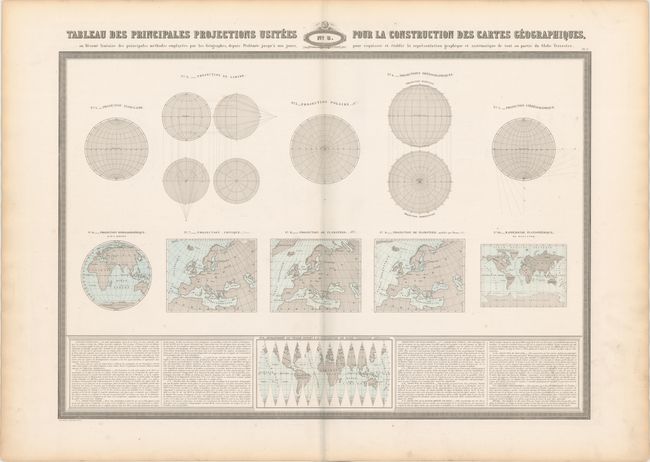
A. No. 3. Tableau des Principales Projections Usitees pour la Construction des Cartes Geographiques…, hand color. Displays 11 different global projections used by mapmakers including Mercator, Flamsteed and Bonne.
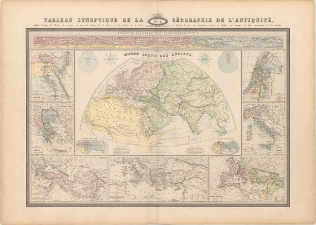
B. No. 4. Tableau Synoptique de la Geographie de l'Antiquite…, hand color. Depicts the ancient world surrounded by eight inset maps including Egypt, Palestine, the Roman Empire and the Peutinger table at top.
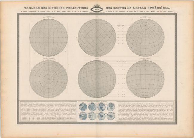
C. No. 11. Tableau des Diverses Projections des Cartes de l'Atlas Spheroidal…, printed color. Shows a variety of spheroidal projections with an explanation at bottom.
References:
Condition: B+
Light toning along the sheet edges and a few small spots. The map of the Ancient World has a 2" centerfold separation at bottom.