Subject: Bay of Biscay, France
Period: 1633-1715 (circa)
Publication:
Color: Hand Color
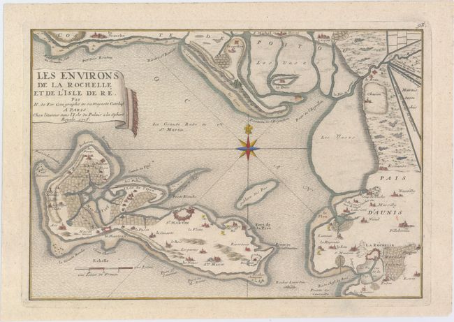
A. Les Environs de la Rochelle et de l'Isle de Re, by Nicolas de Fer, from L'Atlas Curieux, dated 1715 (12.9 x 8.9"). Ref: Pastoureau, FER ID. This lovely chart shows the French seaport La Rochelle, its surroundings, and the Ile de Re in the Bay of Biscay. Several towns and cities are marked by small depictions of fortresses or structures. Salt evaporation ponds appear on the outskirts of La Rochelle, and various ports, canals, marshlands, and rock formations and flats are noted. A compass rose topped with a fleur-de-lis adorns the center of the chart. With an accompanying sheet of text titled Description de la Rochelle et de l'Isle de Re. Condition: On watermarked paper with a few small spots. (A)
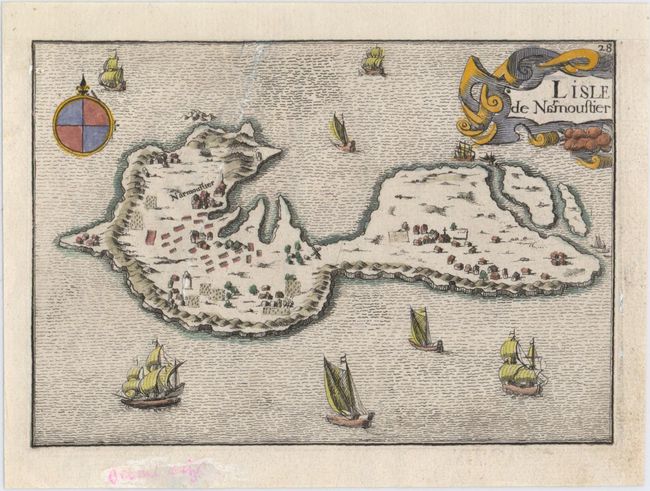
B. L'Isle de Narmoustier, by Nicholas Tassin, from Cartes Generales des Provinces de France et d'Espagne..., circa 1633 (5.9 x 4.1"). Ref: Pastoureau, TASSIN III [28]. This small decorative map provides a bird's-eye view of Noirmoutier-en-l'Ile in the Bay of Biscay. Small depictions of plots of land, a windmill, churches, and other structures appear all over the island. Also included are a decorative title cartouche, a compass rose topped with a fleur-de-lis, and several sailing ships. Condition: The sheet has been remargined at top and there is a 3" diagonal tear running from the neatline at top to the center of the island that has been closed on verso with archival materials. A notation in pink ink appears in the bottom blank margin. (B+)
References:
Condition:
See description above.