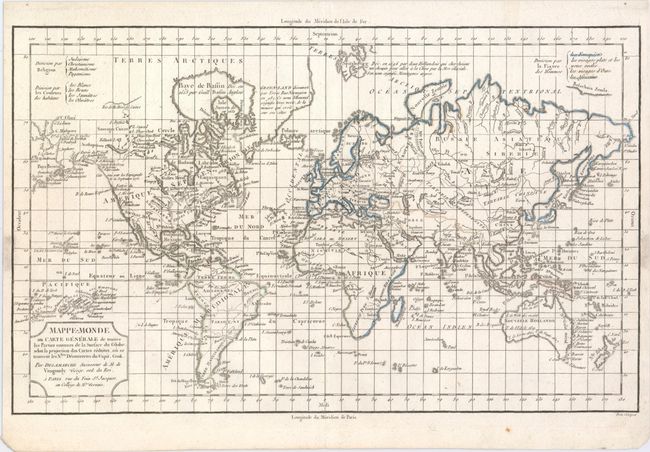
"Mappe-Monde ou Carte Generale de Toutes les Parties Connues de la Surface du Globe, Selon la Projection des Cartes Reduites...", Delamarche, Charles Francois
Subject: World
Period: 1800 (circa)
Publication:
Color: Hand Color
Size:
15.7 x 9.6 inches
39.9 x 24.4 cm
This copper engraved map of the world is drawn on Mercator's projection. Considering the scale, there is good detail of major place names, watershed, and islands of the world. The map has been updated to illustrate the recent discoveries of Cook, La Perouse, Vancouver, and Mackenzie. Notations in the Arctic discuss Erik the Red's discovery of Greenland and Barentz's discovery of Spitsbergen in 1596, and there is good detail of the islands of the Pacific. This map was issued in three versions based on the three legends at top, depicting how the world is divided by religion, skin color, and facial features. This version identifies the four main facial features of the world. Title cartouche notes that Delamarche is the successor to Robert de Vaugondy. Engraved by Dien.
References:
Condition: A