Subject: New York
Period: 1860 (circa)
Publication:
Color: Hand Color
Size:
24 x 19.5 inches
61 x 49.5 cm
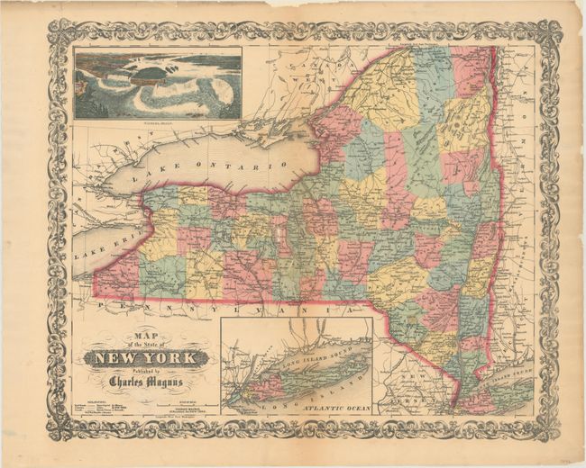
This scarce piece is a decorative map of the state that includes a dramatic and beautiful bird's-eye view of Niagara Falls at upper left. The map is colored by county with much detail of towns and villages, canals, railroads, wagon roads and watershed. A second inset shows all of Long Island on the same scale as the main map. The titling is in fancy text with flourishes and banknote-style pattern behind. A wide, handsome border surrounds. Blank verso. An uncommon map by Charles Magnus, 12 Frankfort St. New York with his own embossed stamp imprinted directly below the title cartouche.
References:
Condition: B
Backed with tissue to reinforce and repair several short tears and two small areas of loss near the center of the map in Seneca and Tomkins county. There is light toning near the middle of the map with a few small edge chips at top confined to the blank margin.