Subject: Western United States
Period: 1883 (dated)
Publication:
Color: Hand Color
Size:
33.4 x 22.5 inches
84.8 x 57.2 cm
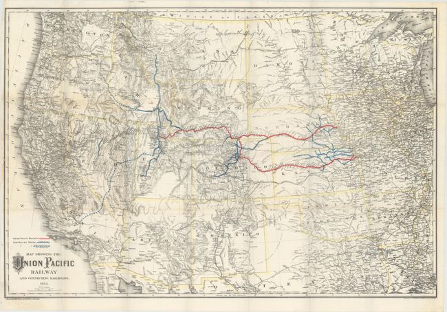
This uncommon map demonstrates the expanding Union Pacific Railway in the western United States. Completed main lines from Omaha and Kansas City through Ogden are colored in red, while ancillary "controlled" roads are shown in blue, and under construction/proposed roads are shown with dotted blue lines. The map is a testament to Colton's attention to detail and accuracy in that it includes scores of obscure little mining towns while leaving unknown areas blank, such as south-central Utah. Designed by Colton, printed by Rufus Adams and published in the 1883 stockholders report.
References:
Condition: A
Issued folding with a hint of toning along a few folds and a narrow, but adequate, left margin due to binding.