Subject: Iowa, Wisconsin & Minnesota
Period: 1838 (dated)
Publication: A General Atlas of the World...
Color: Hand Color
Size:
11.4 x 14.3 inches
29 x 36.3 cm
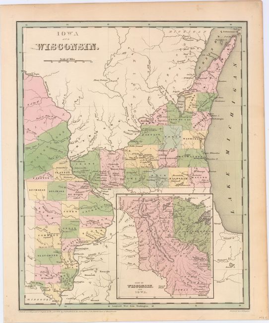
Scarce, early copper engraved map that also includes today's Minnesota. The map extends from Missouri's northern border well into Canada and east to the middle of Lake Michigan. There are 19 named counties in Iowa including the new county of Slaughter, with Sioux and Winnebago lands to the north. Wisconsin is largely unsettled with only 18 counties names. The large inset, based on Nicollet, details the lands of the Dahcota or Sioux, Chippeways, Fox, Iowa, and Saulk Indians, and the watershed of the Missouri and Mississippi Rivers. Early information on forts, rapids, portages, etc. Despite the 1838 date, this was published in 1841, with new counties shown. Still, this was published only three years after Iowa became a territory, and is among the first wave of maps of these territories to appear in commercial atlases. Engraved by G.W. Boynton.
References:
Condition: A
Toning along sheet edges.