Catalog Archive
Auction 149, Lot 177

"[Untitled - Great Plains: Fort Leavenworth to Santa Fe]", U.S. War Department

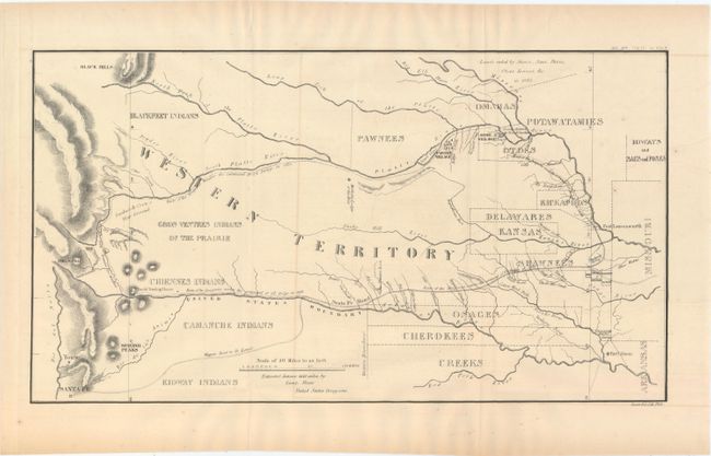
Subject: Central United States

Period: 1860 (circa)

Publication: American State Papers

Color: Black & White

Size:
17.9 x 9.9 inches
45.5 x 25.1 cm
Download High Resolution Image
(or just click on image to launch the Zoom viewer)

This map details the 1835 expedition of Dragoons under the command of Colonel Henry P. Dodge. The map, attributed to Lt. Steen, extends from Pike's Peak, Touse (Taos) and Santa Fe in the west and east to Fort Leavenworth. It locates rivers, mountains, Indian reservations, Indian villages, military posts, and the Santa Fe Trail. The map was originally published in 1836 as part of HR Doc. 181, 24th Cong., 1st Session. A landmark map for illustrating land holdings of the Western Indians.

References: cf: Claussen & Friis #128; cf. Wagner-Camp #63-2; cf. Wheat [TMW] #421.

Condition: B+

Issued folding with just a little faint offsetting.

Estimate: $180 - $220

Sold for: $70

Closed on 5/21/2014

Archived