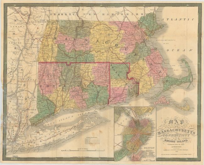
"Map of Massachusetts Connecticut and Rhode Island Constructed from the Latest Authorities", Mitchell/Cowperthwait
Subject: New England
Period: 1850 (dated)
Publication:
Color: Hand Color
Size:
21.8 x 17.2 inches
55.4 x 43.7 cm
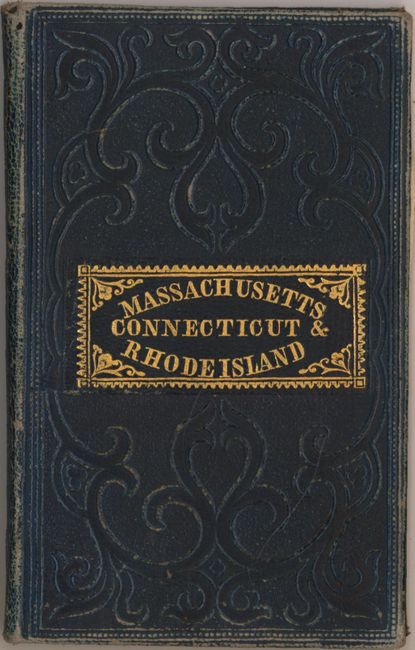
This fine pocket map is very detailed and hand colored by county. It locates roads as well as canals and railroads both existing and proposed. There are a surprising number of railroads already in existence including the Stonington, Worcester, Eastern, Western, New Haven & Springfield, the New York & New Haven and several others. There is an inset of a plan of Boston that includes a key that locates 20 places of interest. Longitude is given from Greenwich and from Washington. Fancy titling and keyboard-style border; printed on banknote style paper. Original pasted paper label on inside front cover gives population by counties and an explanation of the census. Map is "Sold by Thomas, Cowperthwaite & Co. No. 253 Market Street." Folds into blue cloth covers (3.2 x 5") with embossing and gilt stamped title.
References:
Condition: B
The map is now detached from covers with several short fold separations and splits that have been closed on verso with archival tape, and scattered foxing. A small network of binding tears at bottom left has been repaired with archival material on both recto and verso. There is some slight rubbing to covers and spine.