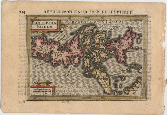
Subject: Philippines
Period: 1618 (published)
Publication: Tabularum Geographicarum Contractarum…
Color: Hand Color
Size:
5.4 x 3.8 inches
13.7 x 9.7 cm
Charming miniature map of the Philippine archipelago, extending south into Borneo, with north oriented to the left. This was one of the first two maps published that focused on the Philippines and used the term Philippines within the title. Based on Plancius' map of 1590, the map depicts Luzon with a truncated southeast peninsula. Samar is shown fairly accurately, here labeled Achan and Tandola, however the islands between Mindanao and Luzon are still depicted in a rudimentary fashion. Palawan is mistakenly labeled Calamianes, which is actually a smaller group of islands between Mindoro and Palawan. The map is embellished with two strapwork cartouches and a moire-patterned sea. French text on verso.
References: Suarez #105; King (2nd ed.) pp. 96-99; Van der Krogt (Vol. III) #8580:342.
Condition: A
A fine impression on watermarked paper with minor show-through of text on verso.