Subject: Western Hemisphere
Period: 1665 (circa)
Publication: Mundus Subterraneus…
Color: Hand Color
Size:
16.4 x 13.6 inches
41.7 x 34.5 cm
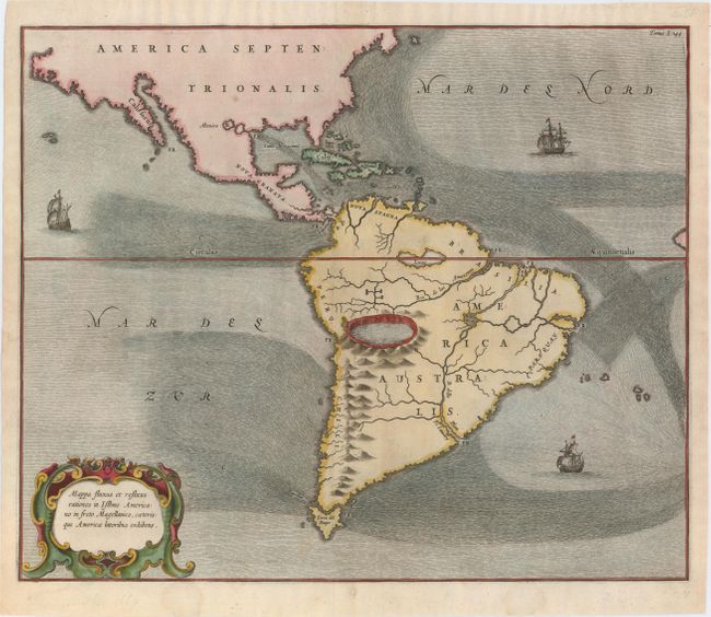
Very unusual map depicting all of South America and most of North America. The map is totally devoid of political detail with the exception of the floating city of Mexico, shown a bit too far north, and California is named. Instead the map features the principal rivers, lakes, mountains and volcanoes in South America. A huge crater lake, probably Lake Titicaca although it is situated too far north, is depicted as the source of the Amazon. The Andes are shown as a range of live volcanoes. Three sailing ships and a strapwork title cartouche adorn the map. Kircher is credited with publishing the first book describing the ocean's currents and this map is a beautiful example of his representations that are surprisingly accurate.
References: Burden #382.
Condition: A
Excellent impression and color on watermarked paper with a very faint damp stain at bottom and a few professionally repaired chips and tears in blank margins.