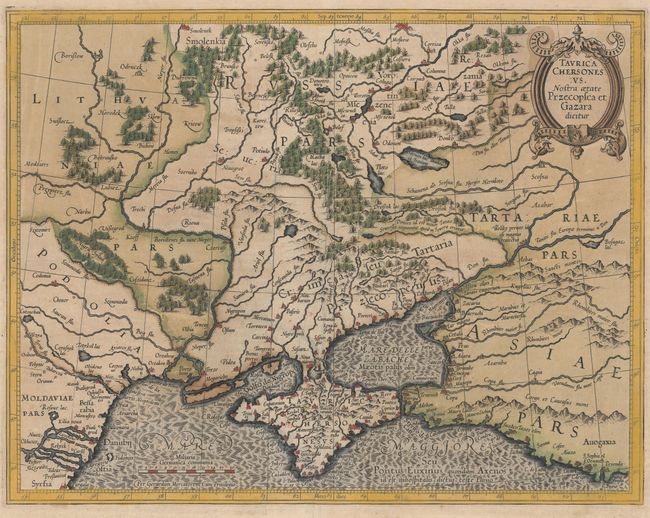
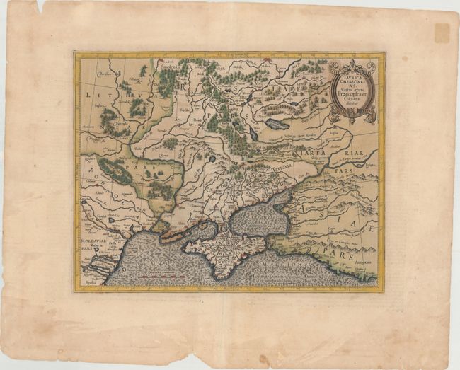
Subject: Ukraine
Period: 1628 (circa)
Publication: Atlas
Color: Hand Color
Size:
15.9 x 12.4 inches
40.4 x 31.5 cm
Mercator's fine map of the region north of the Black sea encompasses the Crimea and the southern steppes of Ukraine. This map served as the basis of most other cartographer's depictions of the region throughout the seventeenth century. The interior is filled with large forests and mountains with little information on settlements except along the rivers. It is embellished with small strapwork title cartouches. French text on verso, published between 1628-33.
References: Vavrichin et al, p. 140-41; Van der Krogt (Vol. I) #1890:1A.1.
Condition: B
Original color with a few tiny abrasions and some small cracks caused by the oxidation of the original green pigment, all of which have been reinforced on verso with archival material. There are some damp stains and tears closed with archival tape in the wide, blank margins.