Subject: Central Europe
Period: 1765 (dated)
Publication:
Color: Hand Color
Size:
38.7 x 28.4 inches
98.3 x 72.1 cm
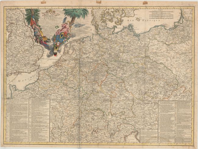
This appealing wall map on two joined sheets centers on Germany and spans from southeast England to Poland. Political divisions, towns and cities, rivers, and mountains are identified. Markings scattered throughout the map indicate the dates and locations of battles as well as the positions of many camps, with corresponding information about the history of war in Europe from 1748 to 1763 in two boxes of text located in the bottom left and bottom right corners. Also included is an elaborate decorative title cartouche complete with putti, an angel, and several coats-of-arms. Engraved by Babel.
References: Phillips #2813.
Condition: B
Issued folding on watermarked paper with a 1" fold separation that has been repaired with non-archival tape on verso and a 2.5" separation where the two sheets are joined. There is also a damp stain that enters the text box at bottom right, light soiling, some minor wear along the folds, and a 5" printer's crease at right. Despite these imperfections, this piece is in nice condition given its size.