Subject: Scotland
Period: 1820-24 (circa)
Publication:
Color: Hand Color
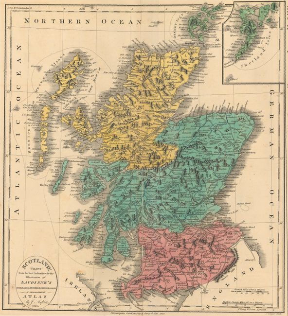
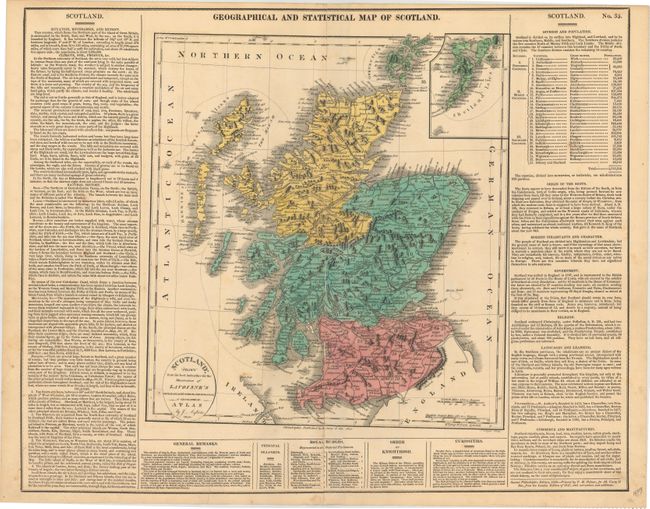
A. Geographical and Statistical Map of Scotland, by M. Carey & Son, from Lavoisne's Genealogical, Historical, Chronological, & Geographical Atlas, dated 1820 (12.3 x 13.6"). This map of Scotland is on a full sheet (20.8 x 16.6") with text on three sides covering geographical, historical, and cultural topics. A small inset features the Shetland Isles. Drawn by J. Aspin and engraved by J. Yeager. Condition: The map has been repaired with archival materials on verso after being split the length of the centerfold. An edge tear enters 1.5" into the text at bottom has been archivally repaired and there is minor scattered foxing, mostly outside of the map image. (B)
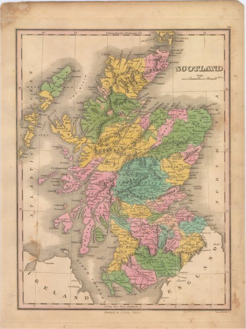
B. Scotland, by Anthony Finley, from A New General Atlas, circa 1824 (8.6 x 11.3"). This attractive map stretches from the southern Orkney Islands to the North Channel, and shows shires, towns, waterways, and mountains. Engraved by Young and Delleker. Condition: Light soiling. (B+)
References:
Condition:
See description above.