Subject: Europe
Period: 1782 (dated)
Publication:
Color: Hand Color
Size:
20.3 x 17.3 inches
51.6 x 43.9 cm
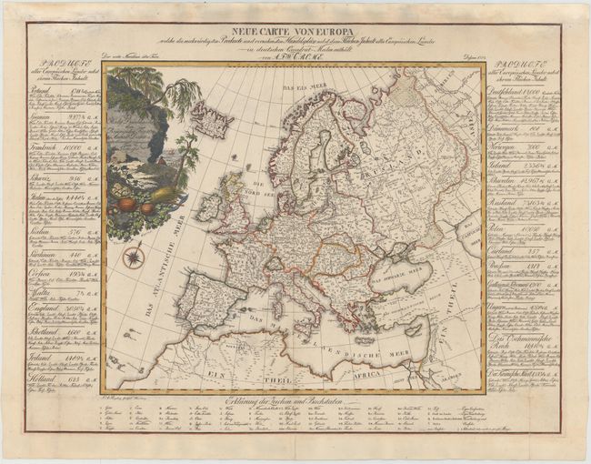
This rare map of Europe was published by August Freidrich Wilhelm Crome, and includes detailed information on the commercial and industrial production of each country. Tables on either side of the map list the products made by each country, and a lettered key at bottom further identifies the specific locations from where these products derive, including gold, silver, honey, fruit, rice, wine, fish, horses, tobacco, pearls, and many more. The map is embellished with a decorative cartouche showing a rocky seaside view with various commodities. With text the sheet measures 28 x 21.3".
References:
Condition: B
A nice impression on watermarked paper with original outline color and later color in the cartouche. Issued folding, now pressed, with professional repairs to several minor fold separations and a few large chips at top, with a portion of top neatline expertly replaced in facsimile.