Subject: Atlantic Ocean
Period: 1785 (circa)
Publication:
Color: Hand Color
Size:
18 x 12.6 inches
45.7 x 32 cm
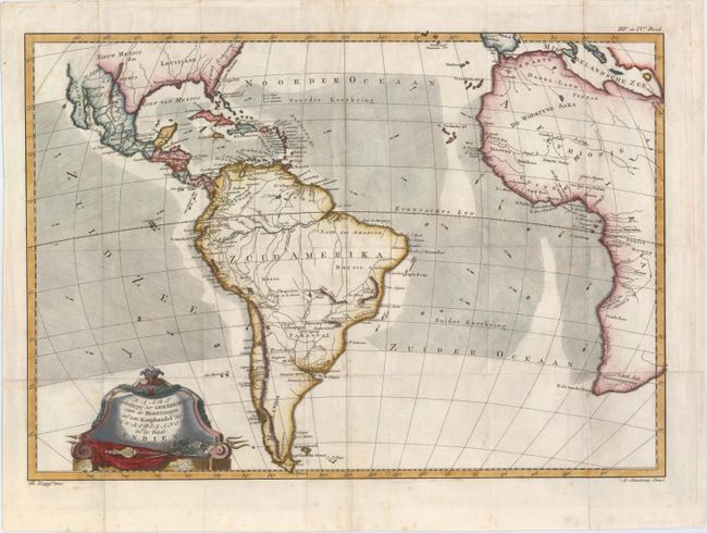
This chart is roughly centered on the Atlantic Ocean and includes most of Africa, the southern part of North America, the West Indies and all of South America. The focus of the chart is European trade and commerce with the Americas. Arrows depict the directions of the currents or prevailing winds in the oceans. There is a fair amount of detail in Central and South America. Two mythical lakes, L. Parim and L. Xarayes, appear in South America. The Baja is here called Californie, and only the cities of New Orleans, Santa Fe and St. Augustine appear in the U.S. Embellished with a decorative title cartouche. The map is based on the work of Rigobert Bonne, who is credited in the title cartouche. Drawn by Th. Koning and engraved by M. Schalekamp.
References:
Condition: B+
Issued folding, now pressed, on watermarked paper with light soiling and minor offsetting.