Subject: Western South America, Peru
Period: 1806-41 (dated)
Publication:
Color: Hand Color
This lot of 3 maps illustrates the fascinating political changes that took place in Peru during the first half of the 19th century.
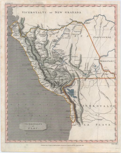
A. Viceroyalty of Peru, by Cadell & Davies, dated 1806, hand color (8.1 x 9.9"). This topographical map depicts Peru extending from Tumbes in the north to past Iquique in the south, well into present-day Chile. Lake Titicaca falls entirely outside of Peru, in the Viceroyalty of La Plata; however the eastern border of Peru encompasses portions of Brazil and Bolivia. Mountains are shown by hachures and rivers are well delineated. Engraved by Lowry. Condition: Watermarked paper with light soiling and one tiny hole in image.
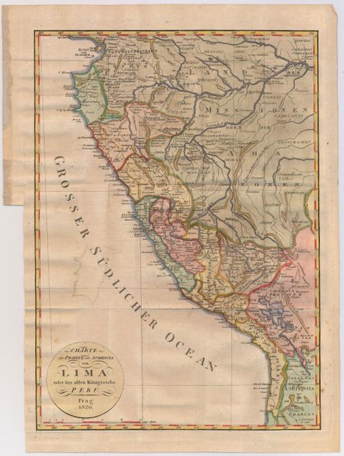
B. Charte der Provinz oder Audiencia von Lima oder des Alten Konigreichs Peru, by Weimar Geographisches Institut, dated 1820, hand color (11.5 x 16.3"). This map was published just 4 years before Peru gained its independence from Spain, and again shows Peru extending from Tumbes in the north to past Iquique in the south, however the Viceroyalty only encompasses a narrow strip along the coast. The majority of the region surrounding the Maranon River is labeled Land der Missionen oder der Amazonen. The map is filled with information on the river systems, mountains, towns, and political boundaries. Condition: Original color on watermarked paper. Issued folding with light offsetting and a few small spots. There is a binding trim at bottom left, but still ample room for framing.
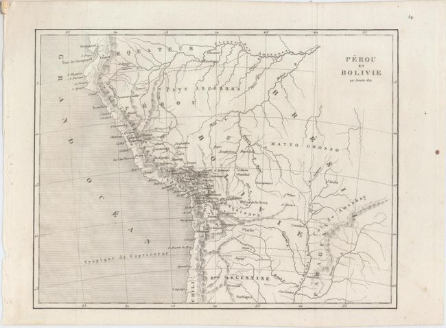
C. Perou et Bolivie, by Frederic Lacroix, from L'Univers Pittoresque Histoire et Description de tous les Peuples, de Leurs Religions, Moeurs Coutumes, etc., dated 1841, black & white (9.0 x 6.9"). Peru, now an independent country, still extends south into present day Chile, and now also encompasses a portion of Lake Titicaca. However Bolivia extends west almost to Cusco. The northeastern portion of Peru is labeled Pays Inconnus (land unknown). There is good detail of the rivers and mountains, with a few place names primarily near the coast. Engraved by Jenotte. Condition: Issued folding with a few tiny spots.
References:
Condition: B+
See descriptions above.