Catalog Archive
Auction 148, Lot 385
"An Accurate Map of the Island of St. Christophers, from an Actual Survey Shewing the Parishes, Churches, and Rivers...", Bew, John
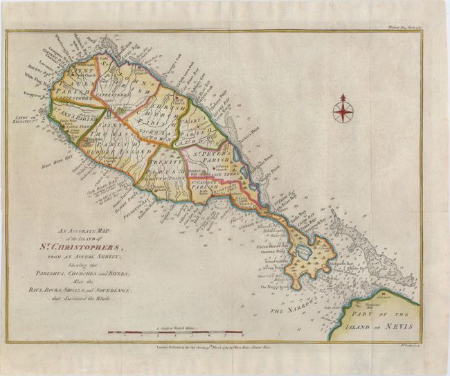
Subject: St. Kitts
Period: 1782 (dated)
Publication: Political Magazine
Color: Hand Color
Size:
14.5 x 10.9 inches
36.8 x 27.7 cm
Download High Resolution Image
(or just click on image to launch the Zoom viewer)
(or just click on image to launch the Zoom viewer)